All Cities
Germany·Europe·GMT+1 · northern clarity

Berlin

Space, silence, straight lines.

Berlin gives the runner space — the widest sidewalks, the flattest parks. Its silence is honest and holds every breath cleanly.

4 soul-aware routes · walking & running
Tiergarten Green Weave — Urban park, flat
Morning·Urban park, flat

Tiergarten Green Weave

9 km+30 m5:15 /km
Step-free
Wikimedia Commons · Tiergarten, Berlin

Linden aisles and forgotten statues keep the pace.

Distance
9km
Elevation
+30m
Mindful tempo
5:15 /km
Elevation profilePaved & fine-gravel garden paths
+30m0.02.34.56.89.0
+30 m gainPeak 30 m · 9 km
Elevation profile: total gain 30 metres, peak 30 m above start, low 0 m.
Tempo engine · Contemplative
Nasal breath
5:05–5:38 /km

Let the shoulders drop every kilometre. Speed is not the point — presence is.

Accessibility · Step-free

No stairs, no stiles. Continuous smooth surface, curb cuts throughout, gentle gradients under 3%.

Wheelchair Stroller Step-free
Along the way
  • Water3–4 drinking fountains · at park gates and central lawns
  • BenchesBenches every 200–400 m through the green sections
  • ToiletsPublic toilets at start/end · park pavilion mid-way
  • ShadeDappled tree shade through the park sections · open at water
  • Rest pointsLawns and lakeside benches every kilometre for a proper sit
Why this route restores

Because green is the frequency the nervous system was tuned for. Every kilometre here is a small argument against the week you just had.

Snapped to real footpaths · Garmin · Strava · AllTrails · Komoot · Coros · Wahoo · Apple Watch · outdooractive
Tempelhof Runway Loop — Open field, dead flat
Golden hour·Open field, dead flat

Tempelhof Runway Loop

6.2 km+8 m5:05 /km
Step-free
Wikimedia Commons · Berlin Tempelhof Airport

Old runways, kites, horizon-only running.

Distance
6.2km
Elevation
+8m
Mindful tempo
5:05 /km
Elevation profileSmooth wide tarmac
+8m0.01.63.14.76.2
+8 m gainPeak 8 m · 6.2 km
Elevation profile: total gain 8 metres, peak 8 m above start, low 0 m.
Tempo engine · Flowing
Nasal breath
4:54–5:25 /km

Ride the line. If effort spikes, ease back into the rhythm — don't push through.

Accessibility · Step-free

No stairs, no stiles. Continuous smooth surface, curb cuts throughout, gentle gradients under 3%.

Wheelchair Stroller Step-free
Along the way
  • WaterPublic fountain at each major square · cafés happy to refill
  • BenchesBenches at every square and along the waterfront
  • ToiletsPublic toilets at start/end · park pavilion mid-way
  • ShadePartial tree shade · carry a cap for high sun
  • Rest pointsCafé terraces and square benches — plenty of civilised places to stop
Why this route restores

Because uninterrupted rhythm is medicine — the body remembers how to move when nothing keeps stopping it.

Snapped to real footpaths · Garmin · Strava · AllTrails · Komoot · Coros · Wahoo · Apple Watch · outdooractive
Spree Heritage Line — River, flat, historic
Dawn·River, flat, historic

Spree Heritage Line

11 km+30 m5:20 /km
Step-free
Wikimedia Commons · Spree (river)

Museum Island, East Side Gallery, quiet water.

Distance
11km
Elevation
+30m
Mindful tempo
5:20 /km
Elevation profilePaved towpath · compacted gravel
+30m0.02.85.58.311.0
+30 m gainPeak 30 m · 11 km
Elevation profile: total gain 30 metres, peak 30 m above start, low 0 m.
Tempo engine · Flowing
5:01–5:34 /km

Ride the line. If effort spikes, ease back into the rhythm — don't push through.

Accessibility · Step-free

No stairs, no stiles. Continuous smooth surface, curb cuts throughout, gentle gradients under 3%.

Wheelchair Stroller Step-free
Along the way
  • Water5–7 drinking fountains along the route · marked at each park gate
  • BenchesBenches every 200–400 m through the green sections
  • ToiletsPublic toilets at 2–3 points along the route · park pavilions and transit hubs
  • ShadeDappled tree shade through the park sections · open at water
  • Rest pointsLawns and lakeside benches every kilometre for a proper sit
Why this route restores

Because old stone teaches long time. When the streets around you have breathed for centuries, your breath lengthens to match.

Snapped to real footpaths · Garmin · Strava · AllTrails · Komoot · Coros · Wahoo · Apple Watch · outdooractive
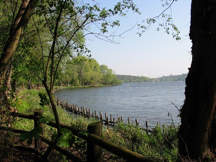
Grunewald Forest Long — Forest, rolling
Morning·Forest, rolling

Grunewald Forest Long

14 km+180 m5:35 /km
Mixed terrain
Wikimedia Commons · Grunewald (forest)

Pine soft-track, Havel light, city forgotten.

Distance
14km
Elevation
+180m
Mindful tempo
5:35 /km
Elevation profileSoft forest track · packed earth
+180m0.03.57.010.514.0
+180 m gainPeak 180 m · 14 km
Elevation profile: total gain 180 metres, peak 180 m above start, low 0 m.
Tempo engine · Recovering
Nasal breath
5:26–6:14 /km

Nasal breath only. If you can't hold the nose, walk 20 steps and restart.

Accessibility · Mixed terrain

Rolling gradients and mixed surfaces. Comfortable for off-road strollers and adaptive trail chairs; not suitable for standard wheelchairs. Long line — rest points every 2–3 km recommended for wheelchair users.

Wheelchair Stroller Step-free
Along the way
  • WaterCarry your own water — one or two springs off-line but no reliable fountains
  • BenchesLog benches at overlooks and trail junctions
  • ToiletsPublic toilets at 2–3 points along the route · park pavilions and transit hubs
  • ShadeDeep tree cover for most of the line
  • Rest pointsOverlook rocks and grass clearings at 2–3 km intervals
Why this route restores

Because green is the frequency the nervous system was tuned for. Every kilometre here is a small argument against the week you just had.

Snapped to real footpaths · Garmin · Strava · AllTrails · Komoot · Coros · Wahoo · Apple Watch · outdooractive
Xymove Composer

Compose a soul-tuned loop

Give it a starting point and a feeling. Xymove reads the land, the light and the soul character — and answers with one composed loop, not a list.

Time of day
Soul emphasis · (2/4)
2 of 4 chosen

One composed loop — real footpaths, park lanes and quiet corridors only. Never a list.

All Cities
One shared standard · Four tempos

The PureSoul family moves with the same heart. Choose the tempo the day is asking for.

Visit the PureSoul Family hub

Shared maps · shared GPX engine · shared Soul Signature language. Whichever door you enter, the craft standard is the same.