All Cities
South Africa·Africa·GMT+2 · Cape light

Cape Town

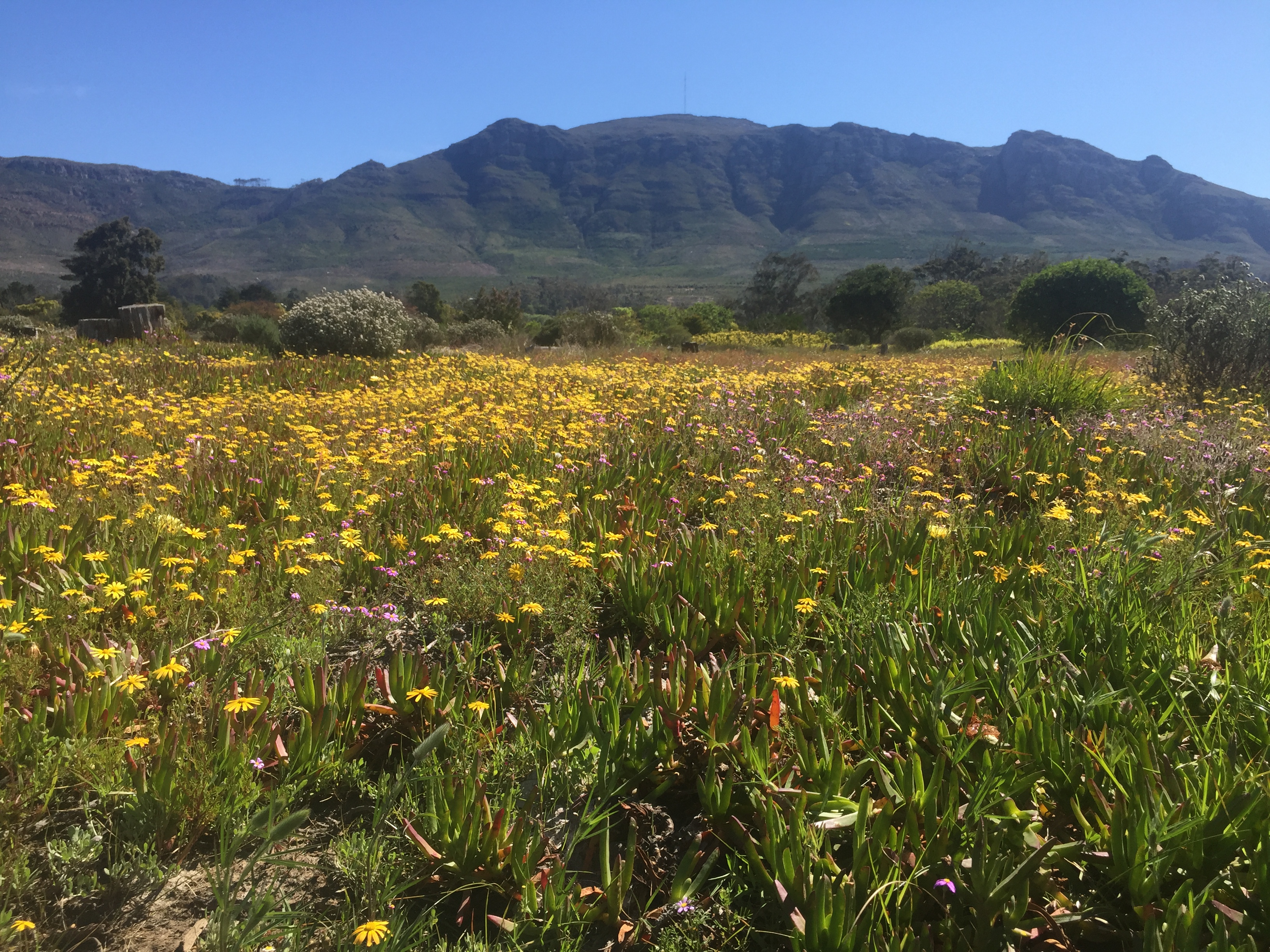
Mountain, ocean, honest wind.

Cape Town runs on a seam — mountain on one side, Atlantic on the other.

6 soul-aware routes · walking & running
Sea Point Promenade — Coastal promenade, flat
Golden hour·Coastal promenade, flat

Sea Point Promenade

8 km+25 m5:12 /km
Mostly accessible
Wikimedia Commons · Sea Point

Table Mountain at your shoulder, Atlantic at your feet.

Start
Sea Point Pavilion (fully step-free · MyCiti bus · accessible parking)
End
Sea Point Pavilion (loop returns to start)
Mindful-pace time
1 h 05 min walking · 32 min running
Step-free rating
★★★★☆ Mostly accessible · adaptive strollers and confident mobility users
Distance
8km
Elevation
+25m
Mindful tempo
5:12 /km
Elevation profilecompacted coastal path with timber-stepped viewpoints
+9m0.02.04.06.08.0
+9 m gainPeak 9 m · 8 km
Elevation profile: total gain 9 metres, peak 9 m above start, low 0 m.
Tempo engine · Flowing
Nasal breath
5:03–5:36 /km

Ride the line. If effort spikes, ease back into the rhythm — don't push through.

Accessibility · Mostly accessible

Predominantly compacted coastal path with timber-stepped viewpoints with a few brief unpaved sections. Off-road strollers and adaptive trail chairs manage well; standard road wheelchairs can complete the paved core.

Wheelchair Stroller Step-free
Along the way
  • WaterRefill at each trailhead and cafe pavilion along the coast
  • BenchesTimber benches at every headland and viewpoint
  • ToiletsAccessible toilets at the trailhead, mid-route pavilion and finish
  • ShadeMilkwood copses at each headland; open sky between them
  • Rest pointsEvery headland is a genuine pause — bench, ocean, wind at eye level
Why this route restores

Because Sea Point at golden hour is Cape Town's most-loved public sanctuary — Table Mountain at your shoulder, the Atlantic at your feet, wind honest.

Snapped to real footpaths · Garmin · Strava · AllTrails · Komoot · Coros · Wahoo · Apple Watch · outdooractive
Signal Hill Contour — Contour path, rolling
Morning·Contour path, rolling

Signal Hill Contour

7.4 km+240 m5:45 /km
Trail — moderate
Wikimedia Commons · Table Mountain

City below, Atlantic pane, wind honest.

Start
Signal Hill lower parking (accessible drive-up · contour path begins flat)
End
Signal Hill lower parking (loop returns to start)
Mindful-pace time
1 h 05 min walking · 35 min running
Step-free rating
★★★☆☆ Trail terrain · confident hikers and all-terrain buggies
Distance
7.4km
Elevation
+240m
Mindful tempo
5:45 /km
Elevation profilecompacted trail with stepped rock sections · elevation-graded
+118m0.01.93.75.67.4
+118 m gainPeak 118 m · 7.4 km
Elevation profile: total gain 118 metres, peak 118 m above start, low 0 m.
Tempo engine · Ascending
Nasal breath
5:37–6:31 /km

Trade cadence for breath on the climbs. Descend soft-footed, not fast.

Accessibility · Trail — moderate

compacted trail with stepped rock sections · elevation-graded. Trail terrain with root, stone or gradient sections. All-terrain buggies and confident mobility users manage carefully; not suitable for standard wheelchairs.

Wheelchair Stroller Step-free
Along the way
  • WaterRefill at the trailhead and the mid-ridge pavilion (carry backup)
  • BenchesTimber benches at each viewpoint and the summit platform
  • ToiletsAccessible toilets at the trailhead only — none on the ridge
  • ShadePatchy tree cover on the ascent; open ridgeline for the crest
  • Rest pointsSummit platform, saddle overlook — the long sit that rewrites your week
Why this route restores

Because Signal Hill's contour above the city bowl is a slow readjustment — the whole peninsula visible, and the wind agreeing that this is enough.

Snapped to real footpaths · Garmin · Strava · AllTrails · Komoot · Coros · Wahoo · Apple Watch · outdooractive
Constantia Greenbelts — Forest greenbelt, rolling
First light·Forest greenbelt, rolling

Constantia Greenbelts

9 km+180 m5:35 /km
Mostly accessible
Wikimedia Commons · Tokai Park

Oak leaf, mountain stream, vineyards near.

Start
Constantia Greenbelt Alphen entrance (accessible parking · buggy-friendly core)
End
Constantia Greenbelt Alphen entrance (loop returns to start)
Mindful-pace time
1 h 20 min walking · 45 min running
Step-free rating
★★★★☆ Mostly accessible · adaptive strollers and confident mobility users
Distance
9km
Elevation
+180m
Mindful tempo
5:35 /km
Elevation profilewide fine-gravel forest track with occasional root sections
+77m0.02.34.56.89.0
+77 m gainPeak 77 m · 9 km
Elevation profile: total gain 77 metres, peak 77 m above start, low 0 m.
Tempo engine · Contemplative
Nasal breath
5:28–6:16 /km

Let the shoulders drop every kilometre. Speed is not the point — presence is.

Accessibility · Mostly accessible

Predominantly wide fine-gravel forest track with occasional root sections with a few brief unpaved sections. Off-road strollers and adaptive trail chairs manage well; standard road wheelchairs can complete the paved core.

Wheelchair Stroller Step-free
Along the way
  • WaterRefill at the trailhead visitor centre and mid-loop pavilion
  • BenchesTimber log benches every 200 m and at each viewpoint
  • ToiletsAccessible toilets at the trailhead and mid-loop pavilion
  • ShadeFull indigenous canopy on the entire loop
  • Rest pointsWaterfall overlook, mid-loop clearing — a stillness the city cannot reach
Why this route restores

Because the Constantia Greenbelts are a network of oak-leaf lanes through a wine valley — mountain streams, quiet homes, and a forest almost nobody knows.

Snapped to real footpaths · Garmin · Strava · AllTrails · Komoot · Coros · Wahoo · Apple Watch · outdooractive
Pipe Track Contour — Mountain contour, level path
First light·Mountain contour, level path

Pipe Track Contour

10 km+180 m5:50 /km
Trail — moderate
Wikimedia Commons · Table Mountain

Table Mountain's western contour at eye level with the Atlantic.

Start
Kloof Nek trailhead · Pipe Track (accessible bus · trail begins on contour)
End
Kloof Nek trailhead · Pipe Track (loop returns to start)
Mindful-pace time
1 h 40 min walking · 55 min running
Step-free rating
★★★☆☆ Trail terrain · confident hikers and all-terrain buggies
Distance
10km
Elevation
+180m
Mindful tempo
5:50 /km
Elevation profilecompacted trail with stepped rock sections · elevation-graded
+90m0.02.55.07.510.0
+90 m gainPeak 90 m · 10 km
Elevation profile: total gain 90 metres, peak 90 m above start, low 0 m.
Tempo engine · Recovering
Nasal breath
5:42–6:30 /km

Nasal breath only. If you can't hold the nose, walk 20 steps and restart.

Accessibility · Trail — moderate

compacted trail with stepped rock sections · elevation-graded. Trail terrain with root, stone or gradient sections. All-terrain buggies and confident mobility users manage carefully; not suitable for standard wheelchairs.

Wheelchair Stroller Step-free
Along the way
  • WaterRefill at the trailhead and the mid-ridge pavilion (carry backup)
  • BenchesTimber benches at each viewpoint and the summit platform
  • ToiletsAccessible toilets at the trailhead only — none on the ridge
  • ShadePatchy tree cover on the ascent; open ridgeline for the crest
  • Rest pointsSummit platform, saddle overlook — the long sit that rewrites your week
Why this route restores

Because the Pipe Track threads Table Mountain's western contour — no summit, just the long civilised line at eye level with the Atlantic.

Snapped to real footpaths · Garmin · Strava · AllTrails · Komoot · Coros · Wahoo · Apple Watch · outdooractive
Kirstenbosch Botanical Loop — World-class botanical garden
Morning·World-class botanical garden

Kirstenbosch Botanical Loop

4.5 km+90 m5:40 /km
Fully step-free
Wikimedia Commons · Kirstenbosch National Botanical Garden

Fynbos rising into forest into mountain — a wide accessible loop.

Start
Kirstenbosch main gate (fully step-free · MyCiti bus · Blue Badge parking · wheelchair loanable)
End
Kirstenbosch main gate (loop returns to start)
Mindful-pace time
55 min walking · 25 min running
Step-free rating
★★★★★ Fully step-free · wheelchair & stroller friendly
Distance
4.5km
Elevation
+90m
Mindful tempo
5:40 /km
Elevation profilesmooth tarmac and stone botanical-garden paths · continuous
+40m0.01.12.33.44.5
+40 m gainPeak 40 m · 4.5 km
Elevation profile: total gain 40 metres, peak 40 m above start, low 0 m.
Tempo engine · Recovering
Nasal breath
5:33–6:12 /km

Nasal breath only. If you can't hold the nose, walk 20 steps and restart.

Accessibility · Fully step-free

Continuous smooth tarmac and stone botanical-garden paths · continuous with curb cuts throughout. Wheelchair, mobility scooter and stroller friendly for the entire loop. Accessible toilets at each major entrance; every ramp under 5%.

Wheelchair Stroller Step-free
Along the way
  • WaterRefill fountains at each garden gate and central pavilion
  • BenchesTimber benches around every pond, garden bed and pavilion
  • ToiletsAccessible toilets at each garden gate and the central pavilion
  • ShadeBotanical canopy on most of the route; open at the pond overlooks
  • Rest pointsPond edges and pavilion terraces — the garden holding you still
Why this route restores

Because Kirstenbosch is one of the great botanical gardens of the world — fynbos rising into forest into mountain, and a wide accessible loop holding it all.

Snapped to real footpaths · Garmin · Strava · AllTrails · Komoot · Coros · Wahoo · Apple Watch · outdooractive
Green Point Urban Park — Urban biodiversity park, flat
First light·Urban biodiversity park, flat

Green Point Urban Park

4 km+12 m5:30 /km
Fully step-free
Wikimedia Commons · Green Point, Cape Town

The most carefully accessible public space — mountain rising behind, ocean ahead.

Start
Green Point Urban Park entrance (fully step-free · MyCiti bus · Blue Badge parking)
End
Green Point Urban Park entrance (loop returns to start)
Mindful-pace time
40 min walking · 20 min running
Step-free rating
★★★★★ Fully step-free · wheelchair & stroller friendly
Distance
4km
Elevation
+12m
Mindful tempo
5:30 /km
Elevation profilesmooth tarmac and fine-gravel park loop · continuous curb cuts
+5m0.01.02.03.04.0
+5 m gainPeak 5 m · 4 km
Elevation profile: total gain 5 metres, peak 5 m above start, low 0 m.
Tempo engine · Recovering
Nasal breath
5:21–5:52 /km

Nasal breath only. If you can't hold the nose, walk 20 steps and restart.

Accessibility · Fully step-free

Continuous smooth tarmac and fine-gravel park loop · continuous curb cuts with curb cuts throughout. Wheelchair, mobility scooter and stroller friendly for the entire loop. Accessible toilets at each major entrance; every ramp under 5%.

Wheelchair Stroller Step-free
Along the way
  • WaterRefill fountains at each park gate and the central pavilion
  • BenchesTimber benches every 80–120 m facing the lawns
  • ToiletsAccessible toilets at the main gate, pavilion and secondary entrances
  • ShadeAncient hardwood canopy on most of the loop
  • Rest pointsCentral pavilion, lawn edge, pond overlook — a proper sit anywhere
Why this route restores

Because Green Point Park is Cape Town's most carefully accessible public space — biodiversity garden, wide loops, mountain rising behind, ocean ahead.

Snapped to real footpaths · Garmin · Strava · AllTrails · Komoot · Coros · Wahoo · Apple Watch · outdooractive
Xymove Composer

Compose a soul-tuned loop

Give it a starting point and a feeling. Xymove reads the land, the light and the soul character — and answers with one composed loop, not a list.

Time of day
Soul emphasis · (2/4)
2 of 4 chosen

One composed loop — real footpaths, park lanes and quiet corridors only. Never a list.

All Cities
One shared standard · Four tempos

The PureSoul family moves with the same heart. Choose the tempo the day is asking for.

Visit the PureSoul Family hub

Shared maps · shared GPX engine · shared Soul Signature language. Whichever door you enter, the craft standard is the same.