All Cities
South Africa·Africa·GMT+2 · high-veld light

Johannesburg

Highland air, jacaranda, ridge lines.

Joburg sits at altitude — every easy run is a lesson in patience with your own breath. Run early, run in the older suburbs, run under the jacarandas.

5 soul-aware routes · walking & running
Delta Park Loop — Suburban park, gentle
First light·Suburban park, gentle

Delta Park Loop

2.6 km+26 m5:50 /km
Fully step-free
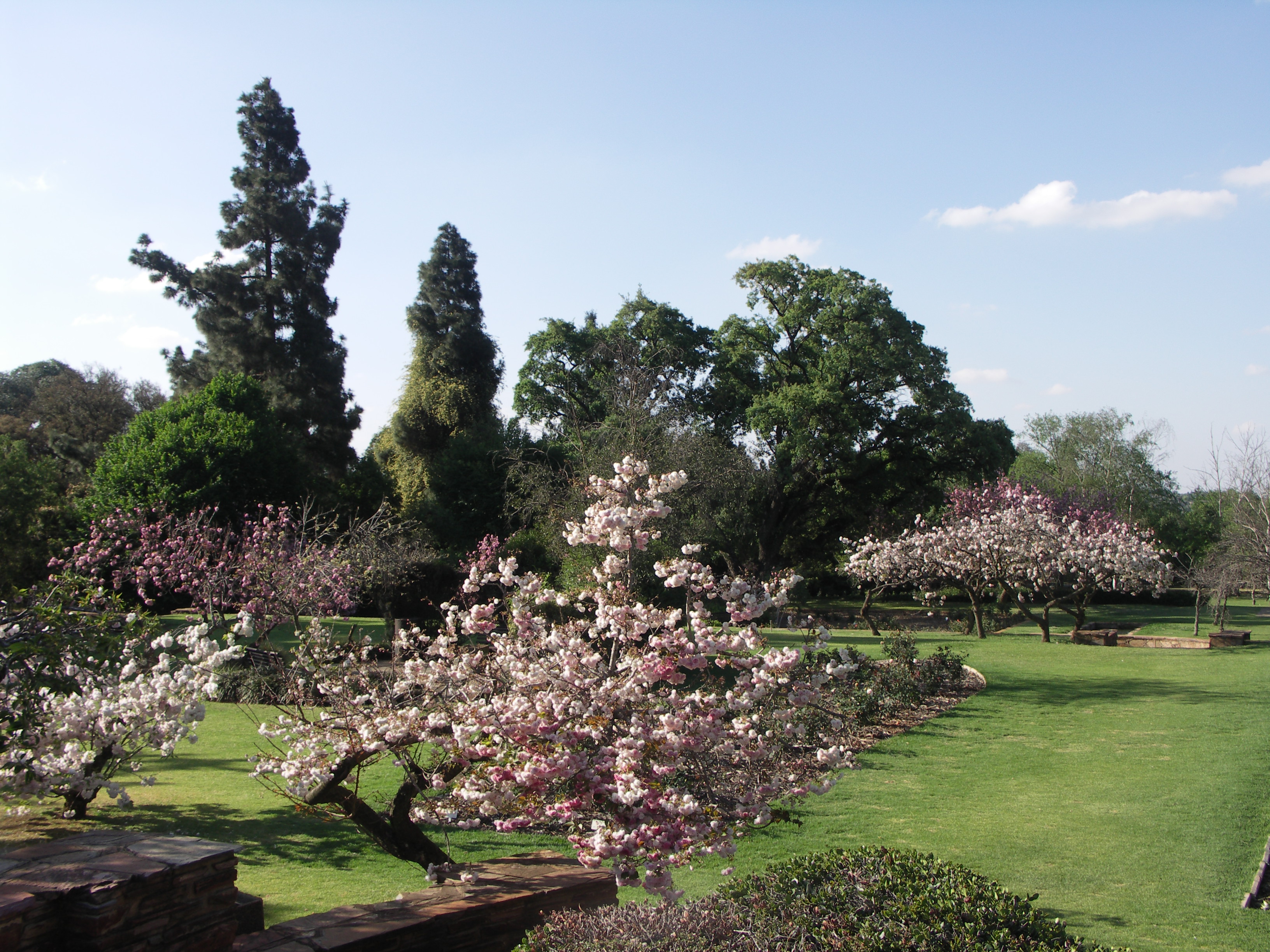
Wikimedia Commons · Delta Park (Johannesburg)

Wetland, bird calls, altitude teaching restraint.

Start
Delta Park Rustenburg Road entrance (accessible parking · buggy-friendly main loop)
End
Delta Park Rustenburg Road entrance (loop returns to start)
Mindful-pace time
50 min walking · 25 min running
Step-free rating
★★★★★ Fully step-free · wheelchair & stroller friendly
Distance
2.6km
Elevation
+26m
Mindful tempo
5:50 /km
Elevation profilesmooth tarmac and fine-gravel park loop · continuous curb cuts
+25m0.00.71.32.02.6
+25 m gainPeak 25 m · 2.6 km
Elevation profile: total gain 25 metres, peak 25 m above start, low 0 m.
Tempo engine · Contemplative
Nasal breath
5:46–6:19 /km

Let the shoulders drop every kilometre. Speed is not the point — presence is.

Accessibility · Fully step-free

Continuous smooth tarmac and fine-gravel park loop · continuous curb cuts with curb cuts throughout. Wheelchair, mobility scooter and stroller friendly for the entire loop. Accessible toilets at each major entrance; every ramp under 5%.

Wheelchair Stroller Step-free
Along the way
  • WaterRefill fountains at each park gate and the central pavilion
  • BenchesTimber benches every 80–120 m facing the lawns
  • ToiletsAccessible toilets at the main gate, pavilion and secondary entrances
  • ShadeAncient hardwood canopy on most of the loop
  • Rest pointsCentral pavilion, lawn edge, pond overlook — a proper sit anywhere
Why this route restores

Because Delta Park is Joburg's oldest patient teacher — a wetland at altitude that asks the breath to slow before it agrees to lengthen.

Snapped to real footpaths · Garmin · Strava · AllTrails · Komoot · Coros · Wahoo · Apple Watch · outdooractive
The Wilds Heritage — Rocky garden, stepped paths
Morning·Rocky garden, stepped paths

The Wilds Heritage

4.4 km+120 m6:00 /km
Mostly accessible
Wikimedia Commons · The Wilds (Johannesburg)

Restored highveld — sculpture and aloes on the ridge.

Start
The Wilds Houghton entrance (accessible parking · stepped rockery paths)
End
The Wilds Houghton entrance (loop returns to start)
Mindful-pace time
45 min walking · 22 min running
Step-free rating
★★★★☆ Mostly accessible · adaptive strollers and confident mobility users
Distance
4.4km
Elevation
+120m
Mindful tempo
6:00 /km
Elevation profilewarm ochre stone pedestrian lanes and courtyards
+46m0.01.12.23.34.4
+46 m gainPeak 46 m · 4.4 km
Elevation profile: total gain 46 metres, peak 46 m above start, low 0 m.
Tempo engine · Contemplative
Nasal breath
5:47–6:29 /km

Let the shoulders drop every kilometre. Speed is not the point — presence is.

Accessibility · Mostly accessible

Predominantly warm ochre stone pedestrian lanes and courtyards with a few brief unpaved sections. Off-road strollers and adaptive trail chairs manage well; standard road wheelchairs can complete the paved core.

Wheelchair Stroller Step-free
Along the way
  • WaterPublic fountains at each riad courtyard and gate
  • BenchesStone benches around the courtyards and garden edges
  • ToiletsAccessible toilets at the visitor centre and main riad
  • ShadeDeep ochre-wall shade through the lanes
  • Rest pointsAny riad courtyard or garden fountain edge — heritage as regeneration
Why this route restores

Because The Wilds was rescued sculpture-by-sculpture into a highveld garden of restored aloes — proof that a neighbourhood can heal its own hillside.

Snapped to real footpaths · Garmin · Strava · AllTrails · Komoot · Coros · Wahoo · Apple Watch · outdooractive
Melville Koppies Ridge — Ridge trail, rocky
Golden hour·Ridge trail, rocky

Melville Koppies Ridge

5.2 km+140 m5:55 /km
Trail — moderate
Wikimedia Commons · Melville Koppies

Ancient rock, city 360° — sunset burns copper.

Start
Melville Koppies East entrance (accessible visitor centre · rocky ridge trail)
End
Melville Koppies East entrance (loop returns to start)
Mindful-pace time
55 min walking · 30 min running
Step-free rating
★★★☆☆ Trail terrain · confident hikers and all-terrain buggies
Distance
5.2km
Elevation
+140m
Mindful tempo
5:55 /km
Elevation profilecompacted trail with stepped rock sections · elevation-graded
+72m0.01.32.63.95.2
+72 m gainPeak 72 m · 5.2 km
Elevation profile: total gain 72 metres, peak 72 m above start, low 0 m.
Tempo engine · Ascending
5:44–6:28 /km

Trade cadence for breath on the climbs. Descend soft-footed, not fast.

Accessibility · Trail — moderate

compacted trail with stepped rock sections · elevation-graded. Trail terrain with root, stone or gradient sections. All-terrain buggies and confident mobility users manage carefully; not suitable for standard wheelchairs.

Wheelchair Stroller Step-free
Along the way
  • WaterRefill at the trailhead and the mid-ridge pavilion (carry backup)
  • BenchesTimber benches at each viewpoint and the summit platform
  • ToiletsAccessible toilets at the trailhead only — none on the ridge
  • ShadePatchy tree cover on the ascent; open ridgeline for the crest
  • Rest pointsSummit platform, saddle overlook — the long sit that rewrites your week
Why this route restores

Because the Koppies are pre-human rock at the top of the ridge — an hour here is copper sunset and 360° city held gently below.

Snapped to real footpaths · Garmin · Strava · AllTrails · Komoot · Coros · Wahoo · Apple Watch · outdooractive
Emmarentia Dam Long — Dam & botanical gardens
Dawn·Dam & botanical gardens

Emmarentia Dam Long

10 km+90 m5:30 /km
Fully step-free
Wikimedia Commons · Johannesburg Botanical Garden

Water, rose garden, long soft loops.

Start
Emmarentia Dam main gate (fully step-free · accessible parking · rose garden circuit)
End
Emmarentia Dam main gate (loop returns to start)
Mindful-pace time
1 h 10 min walking · 35 min running
Step-free rating
★★★★★ Fully step-free · wheelchair & stroller friendly
Distance
10km
Elevation
+90m
Mindful tempo
5:30 /km
Elevation profilesmooth tarmac and stone botanical-garden paths · continuous
+25m0.02.55.07.510.0
+25 m gainPeak 25 m · 10 km
Elevation profile: total gain 25 metres, peak 25 m above start, low 0 m.
Tempo engine · Recovering
Nasal breath
5:17–5:56 /km

Nasal breath only. If you can't hold the nose, walk 20 steps and restart.

Accessibility · Fully step-free

Continuous smooth tarmac and stone botanical-garden paths · continuous with curb cuts throughout. Wheelchair, mobility scooter and stroller friendly for the entire loop. Accessible toilets at each major entrance; every ramp under 5%.

Wheelchair Stroller Step-free
Along the way
  • WaterRefill fountains at each garden gate and central pavilion
  • BenchesTimber benches around every pond, garden bed and pavilion
  • ToiletsAccessible toilets at each garden gate and the central pavilion
  • ShadeBotanical canopy on most of the route; open at the pond overlooks
  • Rest pointsPond edges and pavilion terraces — the garden holding you still
Why this route restores

Because Emmarentia's dam and rose garden are Joburg's soft assurance that a highveld city can hold water, colour and long slow loops in the same square.

Snapped to real footpaths · Garmin · Strava · AllTrails · Komoot · Coros · Wahoo · Apple Watch · outdooractive
Walter Sisulu Botanical Falls — Botanical garden with waterfall
Morning·Botanical garden with waterfall

Walter Sisulu Botanical Falls

6 km+90 m5:45 /km
Fully step-free
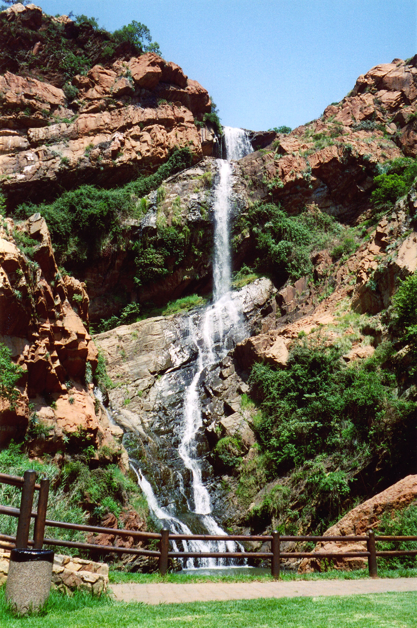
Wikimedia Commons · Walter Sisulu National Botanical Garden

Verreaux's eagles nest on the cliff — a waterfall in the middle of a botanical garden.

Start
Walter Sisulu Botanical Garden main gate (fully step-free · Blue Badge parking · wheelchair loanable)
End
Walter Sisulu Botanical Garden main gate (loop returns to start)
Mindful-pace time
1 h walking · 30 min running
Step-free rating
★★★★★ Fully step-free · wheelchair & stroller friendly
Distance
6km
Elevation
+90m
Mindful tempo
5:45 /km
Elevation profilesmooth tarmac and stone botanical-garden paths · continuous
+33m0.01.53.04.56.0
+33 m gainPeak 33 m · 6 km
Elevation profile: total gain 33 metres, peak 33 m above start, low 0 m.
Tempo engine · Contemplative
Nasal breath
5:38–6:17 /km

Let the shoulders drop every kilometre. Speed is not the point — presence is.

Accessibility · Fully step-free

Continuous smooth tarmac and stone botanical-garden paths · continuous with curb cuts throughout. Wheelchair, mobility scooter and stroller friendly for the entire loop. Accessible toilets at each major entrance; every ramp under 5%.

Wheelchair Stroller Step-free
Along the way
  • WaterRefill fountains at each garden gate and central pavilion
  • BenchesTimber benches around every pond, garden bed and pavilion
  • ToiletsAccessible toilets at each garden gate and the central pavilion
  • ShadeBotanical canopy on most of the route; open at the pond overlooks
  • Rest pointsPond edges and pavilion terraces — the garden holding you still
Why this route restores

Because Walter Sisulu Botanical is Joburg's proper waterfall garden — cliffs, black eagles overhead, and a wide accessible loop holding the whole valley.

Snapped to real footpaths · Garmin · Strava · AllTrails · Komoot · Coros · Wahoo · Apple Watch · outdooractive
Xymove Composer

Compose a soul-tuned loop

Give it a starting point and a feeling. Xymove reads the land, the light and the soul character — and answers with one composed loop, not a list.

Time of day
Soul emphasis · (2/4)
2 of 4 chosen

One composed loop — real footpaths, park lanes and quiet corridors only. Never a list.

All Cities
One shared standard · Four tempos

The PureSoul family moves with the same heart. Choose the tempo the day is asking for.

Visit the PureSoul Family hub

Shared maps · shared GPX engine · shared Soul Signature language. Whichever door you enter, the craft standard is the same.