All Cities
Japan·Asia·GMT+9 · river-basin light

Osaka

Water city, castle heart, kitchen soul.

Osaka is water and warmth — twin rivers ring the centre, and the castle moat is the city's held pulse.

5 soul-aware routes · walking & running
Osaka Castle Moat Loop — Castle moat, smooth tarmac
First light·Castle moat, smooth tarmac

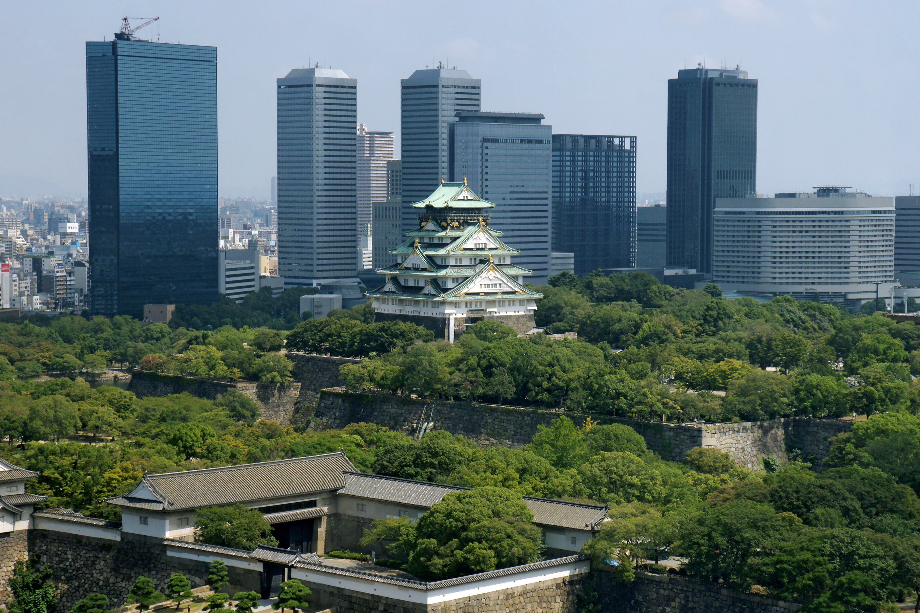
Osaka Castle Moat Loop

4.5 km+25 m5:30 /km
Mostly accessible
Wikimedia Commons · Osaka Castle

The city's most-loved runner loop — a smooth ring around 400 years of quiet stone.

Start
Osaka-jo Otemon Gate (fully step-free · Tanimachi 4-chome subway · Blue Badge parking)
End
Osaka-jo Otemon Gate (loop returns to start)
Mindful-pace time
45 min walking · 22 min running
Step-free rating
★★★★☆ Mostly accessible · adaptive strollers and confident mobility users
Distance
4.5km
Elevation
+25m
Mindful tempo
5:30 /km
Elevation profilewarm stone plaza and pedestrian heritage lanes
+12m0.01.12.33.44.5
+12 m gainPeak 12 m · 4.5 km
Elevation profile: total gain 12 metres, peak 12 m above start, low 0 m.
Tempo engine · Flowing
Nasal breath
5:21–5:54 /km

Ride the line. If effort spikes, ease back into the rhythm — don't push through.

Accessibility · Mostly accessible

Predominantly warm stone plaza and pedestrian heritage lanes with a few brief unpaved sections. Off-road strollers and adaptive trail chairs manage well; standard road wheelchairs can complete the paved core.

Wheelchair Stroller Step-free
Along the way
  • WaterPublic fountains at each plaza and shrine forecourt
  • BenchesStone benches around the plazas and along the pedestrian lanes
  • ToiletsAccessible toilets at the visitor centre and the main plaza
  • ShadeBuilding shade for most of the lanes; open sky at the plazas
  • Rest pointsPlaza fountain edges and heritage courtyards — the city agreeing to slow
Why this route restores

Because Osaka Castle's outer moat is the city's most-loved runner loop — a smooth tarmac ring around 400 years of quiet stone.

Snapped to real footpaths · Garmin · Strava · AllTrails · Komoot · Coros · Wahoo · Apple Watch · outdooractive
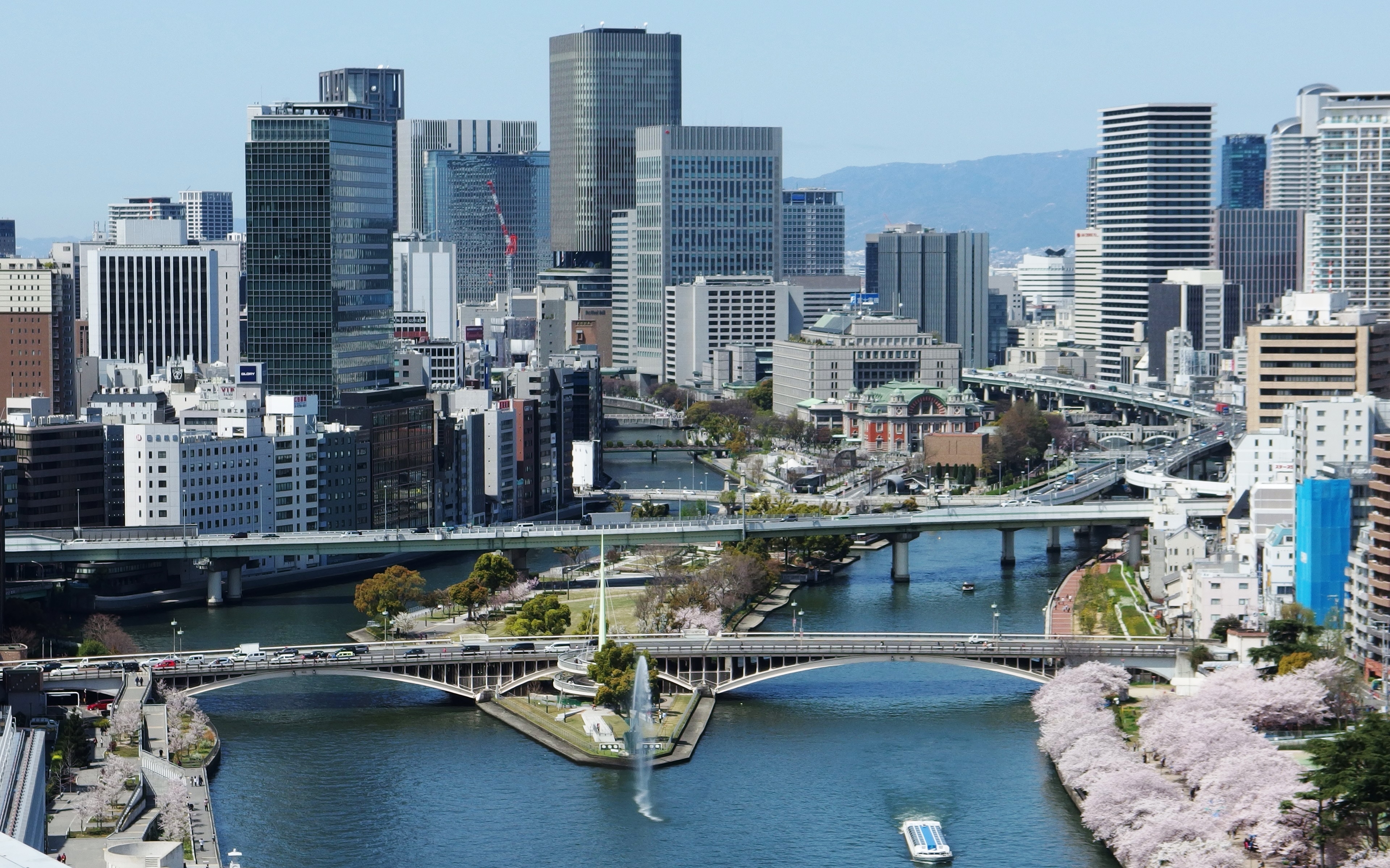
Nakanoshima Riverside — Island between two rivers
Dawn·Island between two rivers

Nakanoshima Riverside

6 km+8 m5:20 /km
Fully step-free
Wikimedia Commons · Nakanoshima

An island where two rivers agreed to hold a rose garden — walk both banks.

Start
Nakanoshima Rose Garden (fully step-free · Naniwabashi subway · accessible riverside)
End
Nakanoshima Rose Garden (loop returns to start)
Mindful-pace time
55 min walking · 28 min running
Step-free rating
★★★★★ Fully step-free · wheelchair & stroller friendly
Distance
6km
Elevation
+8m
Mindful tempo
5:20 /km
Elevation profilewide flagstone riverside path · gentle gradient · continuous
+4m0.01.53.04.56.0
+4 m gainPeak 4 m · 6 km
Elevation profile: total gain 4 metres, peak 4 m above start, low 0 m.
Tempo engine · Flowing
Nasal breath
5:11–5:42 /km

Ride the line. If effort spikes, ease back into the rhythm — don't push through.

Accessibility · Fully step-free

Continuous wide flagstone riverside path · gentle gradient · continuous with curb cuts throughout. Wheelchair, mobility scooter and stroller friendly for the entire loop. Accessible toilets at each major entrance; every ramp under 5%.

Wheelchair Stroller Step-free
Along the way
  • WaterRefill fountains at each bridge and riverside plaza
  • BenchesTimber benches every 80 m facing the water
  • ToiletsAccessible toilets at the major bridges and river plazas
  • ShadeCherry, willow and plane canopy along most of the bank
  • Rest pointsBridge overlooks and river terraces — a river-facing sit anywhere
Why this route restores

Because Nakanoshima is an island in the middle of the city where two rivers agreed to hold a rose garden — walk both banks, one river each way.

Snapped to real footpaths · Garmin · Strava · AllTrails · Komoot · Coros · Wahoo · Apple Watch · outdooractive
Utsubo Park Rose Loop — Small park, extraordinary roses
First light·Small park, extraordinary roses

Utsubo Park Rose Loop

3 km+8 m5:35 /km
Fully step-free
Wikimedia Commons · Utsubo Park

A corrective, at any hour, to a city too busy for itself.

Start
Utsubo Park east gate (fully step-free · Awaza subway · Blue Badge parking)
End
Utsubo Park east gate (loop returns to start)
Mindful-pace time
30 min walking · 15 min running
Step-free rating
★★★★★ Fully step-free · wheelchair & stroller friendly
Distance
3km
Elevation
+8m
Mindful tempo
5:35 /km
Elevation profilesmooth tarmac and fine-gravel park loop · continuous curb cuts
+3m0.00.81.52.33.0
+3 m gainPeak 3 m · 3 km
Elevation profile: total gain 3 metres, peak 3 m above start, low 0 m.
Tempo engine · Recovering
Nasal breath
5:27–5:58 /km

Nasal breath only. If you can't hold the nose, walk 20 steps and restart.

Accessibility · Fully step-free

Continuous smooth tarmac and fine-gravel park loop · continuous curb cuts with curb cuts throughout. Wheelchair, mobility scooter and stroller friendly for the entire loop. Accessible toilets at each major entrance; every ramp under 5%.

Wheelchair Stroller Step-free
Along the way
  • WaterRefill fountains at each park gate and the central pavilion
  • BenchesTimber benches every 80–120 m facing the lawns
  • ToiletsAccessible toilets at the main gate, pavilion and secondary entrances
  • ShadeAncient hardwood canopy on most of the loop
  • Rest pointsCentral pavilion, lawn edge, pond overlook — a proper sit anywhere
Why this route restores

Because Utsubo is a small park with an extraordinary rose garden — a corrective, at any hour, to a city too busy for itself.

Snapped to real footpaths · Garmin · Strava · AllTrails · Komoot · Coros · Wahoo · Apple Watch · outdooractive
Minoh Forest Waterfall — Forest sanctuary, waterfall reward
Morning·Forest sanctuary, waterfall reward

Minoh Forest Waterfall

8 km+200 m5:50 /km
Mostly accessible
Wikimedia Commons · Minoh

A train ride into a forest sanctuary — maples in autumn, monkeys year-round.

Start
Minoh Station (accessible train from Umeda · buggy-friendly first 1.5 km to waterfall)
End
Minoh Station (loop returns to start)
Mindful-pace time
1 h 40 min walking · 55 min running
Step-free rating
★★★★☆ Mostly accessible · adaptive strollers and confident mobility users
Distance
8km
Elevation
+200m
Mindful tempo
5:50 /km
Elevation profilewide fine-gravel forest track with occasional root sections
+102m0.02.04.06.08.0
+102 m gainPeak 102 m · 8 km
Elevation profile: total gain 102 metres, peak 102 m above start, low 0 m.
Tempo engine · Recovering
Nasal breath
5:43–6:33 /km

Nasal breath only. If you can't hold the nose, walk 20 steps and restart.

Accessibility · Mostly accessible

Predominantly wide fine-gravel forest track with occasional root sections with a few brief unpaved sections. Off-road strollers and adaptive trail chairs manage well; standard road wheelchairs can complete the paved core.

Wheelchair Stroller Step-free
Along the way
  • WaterRefill at the trailhead visitor centre and mid-loop pavilion
  • BenchesTimber log benches every 200 m and at each viewpoint
  • ToiletsAccessible toilets at the trailhead and mid-loop pavilion
  • ShadeFull indigenous canopy on the entire loop
  • Rest pointsWaterfall overlook, mid-loop clearing — a stillness the city cannot reach
Why this route restores

Because Minoh's waterfall trail turns a train ride into a forest sanctuary — maple canopy in autumn, monkeys year-round, and a genuine waterfall as reward.

Snapped to real footpaths · Garmin · Strava · AllTrails · Komoot · Coros · Wahoo · Apple Watch · outdooractive
Tempozan Bayfront — Industrial bayfront, walkable
Golden hour·Industrial bayfront, walkable

Tempozan Bayfront

5.5 km+10 m5:30 /km
Fully step-free
Wikimedia Commons · Osaka Bay

Cranes, Ferris wheel, and the bay opening westward.

Start
Tempozan Harbour Village (fully step-free · Osakako subway · accessible pier)
End
Tempozan Harbour Village (loop returns to start)
Mindful-pace time
1 h 05 min walking · 30 min running
Step-free rating
★★★★★ Fully step-free · wheelchair & stroller friendly
Distance
5.5km
Elevation
+10m
Mindful tempo
5:30 /km
Elevation profilewide flagstone waterfront promenade · engineered for shared use
+4m0.01.42.84.15.5
+4 m gainPeak 4 m · 5.5 km
Elevation profile: total gain 4 metres, peak 4 m above start, low 0 m.
Tempo engine · Flowing
Nasal breath
5:21–5:52 /km

Ride the line. If effort spikes, ease back into the rhythm — don't push through.

Accessibility · Fully step-free

Continuous wide flagstone waterfront promenade · engineered for shared use with curb cuts throughout. Wheelchair, mobility scooter and stroller friendly for the entire loop. Accessible toilets at each major entrance; every ramp under 5%.

Wheelchair Stroller Step-free
Along the way
  • WaterRefill fountains at each pier and public plaza along the promenade
  • BenchesTimber and stone benches every 60 m facing the water
  • ToiletsAccessible toilets at each pier and public plaza
  • ShadeBoardwalk shade sails and covered pavilions at the piers
  • Rest pointsEvery pier is a genuine pause — bench, water view, wind at eye level
Why this route restores

Because Tempozan's bayfront is Osaka's decision to keep its industrial harbour walkable — cranes, Ferris wheel, and the bay opening westward.

Snapped to real footpaths · Garmin · Strava · AllTrails · Komoot · Coros · Wahoo · Apple Watch · outdooractive
Xymove Composer

Compose a soul-tuned loop

Give it a starting point and a feeling. Xymove reads the land, the light and the soul character — and answers with one composed loop, not a list.

Time of day
Soul emphasis · (2/4)
2 of 4 chosen

One composed loop — real footpaths, park lanes and quiet corridors only. Never a list.

All Cities
One shared standard · Four tempos

The PureSoul family moves with the same heart. Choose the tempo the day is asking for.

Visit the PureSoul Family hub

Shared maps · shared GPX engine · shared Soul Signature language. Whichever door you enter, the craft standard is the same.