All Cities
Israel·Middle East·GMT+2 · Mediterranean gold

Tel Aviv

Beach line, boulevard shade, salt in the air.

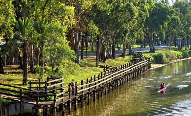
Tel Aviv runs on the tayelet — the whole city moves along the sea at first light, and the boulevards hold shade for the return.

4 soul-aware routes · walking & running
Tayelet Sea Promenade — Coastal boardwalk, flat
Sunrise·Coastal boardwalk, flat

Tayelet Sea Promenade

12 km+20 m5:00 /km
Step-free
Wikimedia Commons · Tel Aviv Promenade

Jaffa old port back to the marina — Med on your left.

Distance
12km
Elevation
+20m
Mindful tempo
5:00 /km
Elevation profileBoardwalk with sections of compacted sand
+20m0.03.06.09.012.0
+20 m gainPeak 20 m · 12 km
Elevation profile: total gain 20 metres, peak 20 m above start, low 0 m.
Tempo engine · Flowing
4:41–5:13 /km

Ride the line. If effort spikes, ease back into the rhythm — don't push through.

Accessibility · Step-free

No stairs, no stiles. Continuous smooth surface, curb cuts throughout, gentle gradients under 3%. Long line — rest points every 2–3 km recommended for wheelchair users.

Wheelchair Stroller Step-free
Along the way
  • WaterCafé refill stops every 2–3 km · public fountains at squares
  • BenchesBenches at every square and along the waterfront
  • ToiletsPublic toilets at 2–3 points along the route · park pavilions and transit hubs
  • ShadePartial tree shade · carry a cap for high sun
  • Rest pointsCafé terraces and square benches — plenty of civilised places to stop
Why this route restores

Because moving beside water borrows its willingness — the current does part of the settling for you.

Snapped to real footpaths · Garmin · Strava · AllTrails · Komoot · Coros · Wahoo · Apple Watch · outdooractive
Yarkon Park River — River park, flat
Dawn·River park, flat

Yarkon Park River

10 km+15 m5:10 /km
Step-free
Wikimedia Commons · Yarkon Park

The city's green lung — long, quiet, soft underfoot.

Distance
10km
Elevation
+15m
Mindful tempo
5:10 /km
Elevation profilePaved towpath · compacted gravel
+15m0.02.55.07.510.0
+15 m gainPeak 15 m · 10 km
Elevation profile: total gain 15 metres, peak 15 m above start, low 0 m.
Tempo engine · Recovering
Nasal breath
4:58–5:30 /km

Nasal breath only. If you can't hold the nose, walk 20 steps and restart.

Accessibility · Step-free

No stairs, no stiles. Continuous smooth surface, curb cuts throughout, gentle gradients under 3%.

Wheelchair Stroller Step-free
Along the way
  • Water5–7 drinking fountains along the route · marked at each park gate
  • BenchesBenches every 200–400 m through the green sections
  • ToiletsPublic toilets at 2–3 points along the route · park pavilions and transit hubs
  • ShadeDappled tree shade through the park sections · open at water
  • Rest pointsLawns and lakeside benches every kilometre for a proper sit
Why this route restores

Because uninterrupted rhythm is medicine — the body remembers how to move when nothing keeps stopping it.

Snapped to real footpaths · Garmin · Strava · AllTrails · Komoot · Coros · Wahoo · Apple Watch · outdooractive
Rothschild Boulevard — Tree-lined boulevard, flat
First light·Tree-lined boulevard, flat

Rothschild Boulevard

4.4 km+10 m5:25 /km
Step-free
Wikimedia Commons · Rothschild Boulevard

Bauhaus quiet before the coffee crowds.

Distance
4.4km
Elevation
+10m
Mindful tempo
5:25 /km
Elevation profileSmooth city pavement
+10m0.01.12.23.34.4
+10 m gainPeak 10 m · 4.4 km
Elevation profile: total gain 10 metres, peak 10 m above start, low 0 m.
Tempo engine · Contemplative
Nasal breath
5:19–5:50 /km

Let the shoulders drop every kilometre. Speed is not the point — presence is.

Accessibility · Step-free

No stairs, no stiles. Continuous smooth surface, curb cuts throughout, gentle gradients under 3%.

Wheelchair Stroller Step-free
Along the way
  • WaterPublic fountain at each major square · cafés happy to refill
  • BenchesBenches at every square and along the waterfront
  • ToiletsPublic toilets at start/end · park pavilion mid-way
  • ShadeColonnade and narrow-street shade for the middle third
  • Rest pointsCafé terraces and square benches — plenty of civilised places to stop
Why this route restores

Because old stone teaches long time. When the streets around you have breathed for centuries, your breath lengthens to match.

Snapped to real footpaths · Garmin · Strava · AllTrails · Komoot · Coros · Wahoo · Apple Watch · outdooractive
Old Jaffa Heritage — Old city lanes, cobbled
Golden hour·Old city lanes, cobbled

Old Jaffa Heritage

6 km+60 m5:35 /km
Mostly accessible
Wikimedia Commons · Tel Aviv

Stone alleys, minaret, sea below at dusk.

Distance
6km
Elevation
+60m
Mindful tempo
5:35 /km
Elevation profileCobblestone with smooth-pavement inlays
+60m0.01.53.04.56.0
+60 m gainPeak 60 m · 6 km
Elevation profile: total gain 60 metres, peak 60 m above start, low 0 m.
Tempo engine · Contemplative
Nasal breath
5:23–5:59 /km

Let the shoulders drop every kilometre. Speed is not the point — presence is.

Accessibility · Mostly accessible

Continuous paths with occasional short ramps or gentle slopes. Sturdy strollers and most wheelchairs manage well; a companion is a kindness on the two or three brief rises.

Wheelchair Stroller Step-free
Along the way
  • WaterPublic fountain at each major square · cafés happy to refill
  • BenchesBenches at every square and along the waterfront
  • ToiletsPublic toilets at start/end · park pavilion mid-way
  • ShadeColonnade and narrow-street shade for the middle third
  • Rest pointsCafé terraces and square benches — plenty of civilised places to stop
Why this route restores

Because old stone teaches long time. When the streets around you have breathed for centuries, your breath lengthens to match.

Snapped to real footpaths · Garmin · Strava · AllTrails · Komoot · Coros · Wahoo · Apple Watch · outdooractive
Xymove Composer

Compose a soul-tuned loop

Give it a starting point and a feeling. Xymove reads the land, the light and the soul character — and answers with one composed loop, not a list.

Time of day
Soul emphasis · (2/4)
2 of 4 chosen

One composed loop — real footpaths, park lanes and quiet corridors only. Never a list.

All Cities
One shared standard · Four tempos

The PureSoul family moves with the same heart. Choose the tempo the day is asking for.

Visit the PureSoul Family hub

Shared maps · shared GPX engine · shared Soul Signature language. Whichever door you enter, the craft standard is the same.